Services
Beacon Hill Society
Information about Beacon Hill society
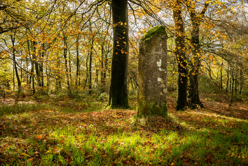
A prominent high point of the east Mendip Hills, Beacon Hill draws the eye. But it bears closer inspection too. A Roman road runs through it. The land is scattered with Bronze Age tumuli and scarred by quarrying activities spanning thousands of years. Deer graze beneath majestic beech trees, silhouetted against far reaching views across the Somerset levels and the bluebells are well known as one of the best shows in the district. It is a special place.
The Beacon Hill Society was formed in 1993 when the Forestry Commission put the 42 acres of Beacon Wood, near Shepton Mallet, up for sale. Local people from a wide range of diverse interests came together to see what they could do to safeguard their continued enjoyment of a popular area.
The Society successfully persuaded Mendip District Council to provide a grant to purchase the site, thereby recognising its value. To ensure the wood was kept in safe hands into the future, the Woodland Trust, a charity organisation with vast experience in woodland management, was chosen to be the new owners.
Public Access
Beacon Hill Wood is situated on a high point of the East Mendip Hills, 2 miles north east of Shepton Mallet. Owned by the Woodland Trust, the wood is open all year round for walkers to enjoy.
There is a public Right of Way (RoW) which follows the course of the Fosse Way north to south through the wood. This route may be used by horse riders and cyclists along the line indicated as a Bridlepath on the attached map.
Following Acts of Parliament in 2000 & 2006, this RoW was reclassified as a Restricted Byway (RB) and public use of any mechanically propelled vehicle (motorcycle or 4×4) was made illegal.
Use of any motorised vehicle, including motorcycles and cars, is therefore not permitted throughout this wood. Riding of bicycles and horses is restricted to the RoW.
Please also respect our neighbours: there is no public access on to adjacent fields
Beacon Hill History
Enclosure Acts and Turnpike Roads
In the 16th century Beacon Hill was known as Rybury, a name which probably had Anglo-Saxon origins. Its earliest depiction on Mendip mining maps of that time also show the symbol for a Beacon, and the ‘Rye Beacon’ is referred to in contemporary documents. This was almost certainly one of the chains of warning beacons across the country established by Elizabeth I. The beacon was probably sited on or beside the round barrows on the summit of the hill, but no trace of it is visible today. Its siting here indicates an open environment, while 17th century sale documents refer to plots of uncultivated land around it (Doles), supporting mainly heather, gorse and bracken.
By the 17th and 18th centuries it was called ‘Beacon Hill’ and Stratchey’s map of 1736 shows the beacon site as a barrow, apparently topped with a stone. Today this monolith of dressed Doulting stone is a prominent marker on the highest point – a large round barrow – though unlikely to be of prehistoric date. It lies at the centre of a slight circular earthwork bank and outer ditch, probably defining an 18th century tree-planting ring.
The later 18th century was time of great changes for Beacon Hill, not least its transformation to woodland and the creation of Beacon Hill Wood. Following the creation of the Wells-Frome Turnpike roads, the ‘common lands and wastes’ in the parishes of Doulting and Stoke Lane were enclosed in 1776. Maps depict a large triangular enclosure bounded by the turnpike road, Boulters Lane and the Fosse Way, with The Beacon at its northwest corner. This land was owned by the Horner family (of the nursery rhyme!), and Thomas Horner of Doulting Manor was probably responsible for the first tree plantings and perhaps the layout of the tree ring and other boundaries to the wood. The Rev. Skinner’s 1823 record of a conversation with an old man who assisted with the tree planting when young, seems to confirm this.
A smaller rectangular piece of woodland west of the Fosse Way lies within the parish of Ashwick (formerly part of Shepton Mallet), which was enclosed in 1785. This was also owned by Thomas Horner and may have been planted by him soon after that date. The junction of the three parishes lies within the wood and is marked by a handsome inscribed parish boundary marker of Doulting stone. Subsequently, that part of the wood lying within Doulting parish came into the ownership of William Melliar Foster Melliar (from 1838), and several of his boundary stones marked ‘WMFM’ are still preserved within the wood on the line of the Fosse Way.
In the 19th century maps become more detailed and accurate, giving a clearer picture of its development. Sketches for the first Ordnance Survey maps in 1808 clearly show the planted tree ring, and a visit by another antiquary – Richard Coalte Hoare in the same year – mention it and the presence of fir trees, although only some of the mature beech trees survive today. Skinner’s sketches of the 1820s do not suggest much woodland outside the ring, although by the time of the Tithe Apportionment maps of the 1840s for the local parishes the wood appears to have been dominated by coniferous plantations. One area not apparently planted until around that time lay to the north of a well defined bank and ditch boundary preserved in the eastern half of the wood. This feature follows the top of the steep scarp slope of the hill, separating woodland on the lower slopes from a rough pasture field – ‘North Close’ This was planted sometime between the 1840s and 1884, when the wood is shown on the 1st Edition 6″ Ordnance Survey map as mixed coniferous and deciduous woodland, and had reached its full extent.
Military Aspects
Whilst Maesbury Castle, 2 miles to the west, was fortified in the Iron Age, Beacon Hill has remained relatively unaffected by national conflict. Certainly the Fosse Way was a Roman military road but this, and the setting up of an Elizabethan warning beacon, had minimal impact.
In the late 19th century a shooting range was set up in the fields alongside the Fosse Way south of the wood, using the steep escarpment as the backdrop for targets placed in the field below. The Ordnance Survey map of 1884 depicts a range over 600yds long starting at Yellingmill Lane, with the location of warning flagstaffs also shown; a stone slab with square hole can still be found in the wood. The small corrugated iron shed seen on the edge of the wood may have been a later store for the targets as the range was active during both world wars.
Also to found in the wood from WWII are several rectangular pits which are believed to be the remains of facilities for a covert British Resistance Organisation, set up separate from the Home Guard by the Secret Intelligence Services. In the event of invasion men of this unit planned to go underground and remain behind enemy lines, to carry out missions of sabotage.
Archaeology
Beacon Wood contains an important group of archaeological remains, spanning some 4,000 years, whose preservation owes much to the presence of the wood itself. Conservation and management of the wood’s environment is now the priority, of which its historical use is no less a part. To assist in this process and gain further insights into the archaeological legacy surviving here a programme of investigations have been undertaken over the past two years or so, with the support of LHI grants obtained through the Woodland Trust.
Beacon Hill probably lost its original woodland cover in the Neolithic period, 5-6000 years ago. By the Bronze Age, around 4000 years ago the hill was open downland, along with much of the Mendip plateau. Even then, however, Beacon Hill was a special place, chosen by the local people as a place of burial and ritual. A line of at least a dozen round barrows crown the ridge, most now preserved within the wood, while others are visible in the open field to the west. These barrows contain cremated human remains and funerary pottery of the early 2nd millennium BC.
Centuries later, in the Iron Age, the pebbly sandstone on the hilltop was quarried to make querns and millstones, which were used in local settlements such as the Glastonbury Lake Villages or South Cadbury Castle. The sandstone and volcanic rocks were also utilised as a source of grit tempering, used to make distinctively decorated Iron Age pottery at Glastonbury in the 2nd and 3rd centuries BC.
In Roman times Beacon Hill was probably at its busiest. Two main roads – The Fosse Way and a road from the Mendip lead mines to Southampton – intersected on the hill top, though little of their original construction is visible today. More apparent are the rakes, quarry pits and working platforms in the wood, that represent a considerable expansion of the stone extraction industry. The querns and millstones that continued to be produced here have been found at Roman settlements like Ilchester, Shepton Mallet or Camerton, as well as at villas and farms in the region. The sandstone was also used as metalling for surfacing the Fosse Way at Shepton Mallet at least.
Continuing research, through surveys (Corney et. al. 2003) and exploratory excavations (see page), particularly of the quarrying and ancient roads, is shedding new light upon Beacon Wood’s rich archaeological heritage.